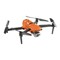
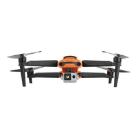
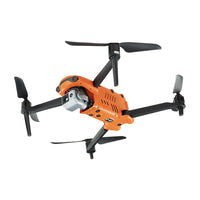
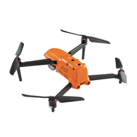
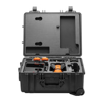
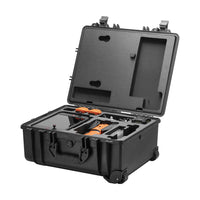
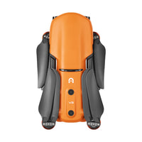
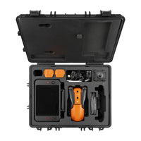
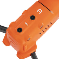
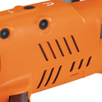
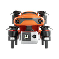
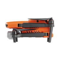
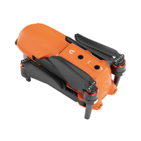
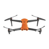
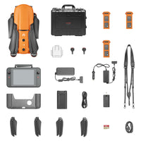
EVO II Dual 640T Rugged Bundle V3
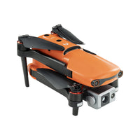
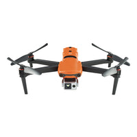
- Dual Camera design with a thermal imaging sensor
- Thermal imaging sensor has a resolution of up to 640x512
- Support 10 Thermal color palettes, 30Hz refresh rate and Picture-in-Picture mode
- 13mm lens and 16x digital zoom capable of recognizing subjects at up to 100m
- Radiometric Temperature Detection
- 0.8" CMOS sensor capable of 50 MP photos
- 360° obstacle avoidance with 19 groups of sensors
- 7.9" Smart Controller V3
- Dynamic Track 2.1
- Industry-leading 38 minutes flight time
- Transmission range of 15KM
Features
A New Generation
Of Thermal Sensor
The new generation of the
Autel Robotics thermal imaging sensor
has a resolution of up to 640x512@30 fps.
It also comes standard with a 13mm lens,
16x digital zoom, and is capable of
recognizing subjects at up to 100 m
away which provides
greater resolution than any camera in its class,
enabling pilots to see deep detail
in dark environments.
360° Obstacle Avoidance
Equipped with 19 groups of sensors — including 12 visual sensors, the main camera, ultrasound, and dual IMUs — the EVO II Pro can easily build three-dimensional maps and plan paths through complex terrain in real time.
Dynamic Track 2.1
The EVO II Pro can model the location and speed of targets simultaneously, predict their trajectory accurately, and track them continuously while identifying up to 64 objects at the same time.
Applications for 640T Thermal drones
The EVO II Dual 640T is a highly advanced drone that can greatly assist hunters in their pursuits. With a dual 640T thermal camera and high-resolution imaging capabilities, hunters can locate and track game from the air. The drone's long flight time and stable flight performance also allow for extended monitoring and observation of wildlife. This cutting-edge technology can help hunters plan and execute successful hunting trips, increasing their chances of making a successful catch.
Specifications
Takeoff weight | 1150 g |
Max takeoff weight | 1999 g |
Size(L*W*H) | 230*130*108mm(folded) 457*558*108mm(unfolded) |
Wheelbase | 397 mm |
Maximum service ceiling altitude | 7000 m |
Max ascent speed | 8 m/s (Ludicrous) |
Max descent speed | 4 m/s (Ludicrous) |
Max horizontal flight speed | 20m/s (Ludicrous) |
Max flight distance (no wind) | 22 km |
Max angular velocity | 120°/s |
Max tilt angle | 33° (Ludicrous) |
Max flight time (no wind) | 38 min |
Max hovering time (no wind) | 33 min |
Operating temperature range | -10℃ ~ 40℃ |
Maximum resistance to wind | Level 8 |
Operating frequency | 902-928MHz (FCC Only) 2.400-2.4835GHz 5.725-5.850GHz (non-Japan) 5.650-5.755GHz (Japan Only) |
Transmission power | 900M FCC/ ISED:≤31dBm 2.4G FCC/ ISED:≤32dBm SRRC/CE/MIC/RCM:≤20dBm 5.8G (non-Japan) ; 5.7G (Japan) FCC/ISED/SRRC/MIC:≤33dBm CE/ RCM:≤14dBm |
Hovering accuracy | Vertical: ±0.1 m (when the visual positioning is working normally); ±0.5 m (when GPS works normally) Horizontal: ±0.3 m (when the visual positioning is working normally); ±1.5 m (when GPS works normally) |
GNSS | GPS/Beidou/Glonass/Gallieo |
Internal storage | 8GB |
SD storage | max. support 256GB (UHS-3 or Class 10) |
Gimbal | 3-axis stabilization |
Mechanical range | Tilt: -135° to +45°; Pan: -100° to +100° |
Controllable rotation range | Tilt: -90° to +30°; Pan: -90° to +90° |
Max control speed (Tilt) | 300°/s |
Angular Vibration Range | ±0.005° |
Operating frequency | 902-928MHz (FCC Only) 2.400-2.4835GHz 5.725-5.850GHz (non-Japan) 5.650-5.755GHz (Japan Only) |
Transmission power | FCC:≤33dBm CE:≤20dBm@2.4G,≤14dBm@5.8G SRRC:≤20dBm@2.4G,≤33dBm@5.8G/5.7G |
Max Transmission Distance (unobstructed, free of interference) | FCC:15km CE:8km |
Display screen | 2048x1536 60fps |
Battery | 5800mAh |
Operating time | ~3 hours (Max. Brightness) ~4.5 hours (50% Brightness) |
Charging time | 120 minutes |
Internal Storage | ROM 128GB |
Sensing system type | Omnidirectional sensing system |
Forward | Accurate measurement range: 0.5-18 m Effective sensing speed: <12m/s Viewing angle: Horizontal: 60°, Vertical: 80° |
Backward | Accurate measurement range: 0.5-16 m Effective sensing speed: <12m/s Viewing angle: Horizontal: 60°, Vertical: 80° |
Upward | Accurate measurement range: 0.5-10 m Effective sensing speed: <5m/s Viewing angle: Horizontal: 65°, Vertical: 50° |
Downward | Accurate measurement range: 0.5-10 m Effective sensing speed: <5m/s Viewing angle: horizontal: 100°, vertical: 80° |
Left and right | Accurate measurement range: 0.5-10 m Effective sensing speed: <5m/s Viewing angle: horizontal: 65°, vertical: 50° |
Operating Environment | Forward, Backward and Sides: Surface with clear pattern and adequate lighting (lux > 15) Upward: Detects diffuse reflective surfaces (>20%) (walls, trees, people, etc.) Downward: Surface with clear pattern and adequate lighting (lux > 15) Detects diffuse reflective surfaces (>20%) (walls, trees, people, etc.) |
Sensor | Uncooled VOx Microbolometer |
Lens | FOV H33°V26° |
Focal length 13mm | |
Zoom | 1 - 16x |
Pixel size | 12μm |
Wavelength range | 8 - 14μm |
Temperature range | High gain mode: -20° to +150° Low gain mode: 0° to +550° |
Temperature measurement accuracy | ±3℃ or ±3% of reading (whichever is greater) @Environmental temperature-20℃~60℃ |
Accurate temperature measurement distance |
2-20 meters |
Video resolution | 640x512@30fps |
Video format | MOV / MP4 (Support H.264/H.265) |
Camera resolution | Infrared mode: 640*512 Picture-in-picture mode: 1920*1080, 1280*720 |
Photo mode | Single shot Burst shooting: 3/5 frames, 3 is the default Time Lapse:JPG: 2s/5s/7s/10s/20s/30s/60s |
Photo format | JPG (with irg file) |
Sensor | 1/1.28"(0.8") CMOS; 50M effective pixels |
Lens | FOV: 85° 35 mm format equivalent focal length: 23 mm Aperture: f/1.9 Focus range: 0.5 m to infinity (with auto focus) |
ISO range | Video: 100-64000 Photo: 100-6400 |
Shutter speed | Photo mode: 1/8000 ~ 8s Other: 1/8000 ~ 1/frame rates |
Zoom | 1-16x (up to 4x lossless zoom) |
Photo mode | Single shot/Burst shooting/AEB/Time Lapse/HDR imaging |
Maximum photo size | 8192*6144(4:3) 4096*3072(4:3) 3840x2160(16:9) |
Image Format | JPG (default) / DNG / JPG+DNG |
Video format | MOV / MP4 |
Video resolution | 3840x2160P60/P50/P48/P30/P25/P24 2720x1528P60/P50/P48/P30/P25/P24 1920x1080P60/P50/P48/P30/P25/P24 |
Max bitrate | 120Mbps |
Supported file system | FAT32/exFAT |
Capacity | 7100 mAh |
Voltage | 11.55 V |
Battery type | LiPo 3S |
Energy | 82 Wh |
Weight | 365 g |
Charging temperature range | 5℃ to 45℃ |
Storage temperature and humidity | -10~30℃,65±20%RH |
Recommended storage temperature | 22-28℃ |
Max charging power | 93W |
Charging time | 90 minutes |
Input | 100-240 V, 50/60 Hz, 1.5A |
Output | 13.2 V ⎓ 5 A 5V⎓3A 9V⎓2A 12V⎓1.5A |
Voltage | 13.2±0.1V |
Rated power | 66W |
Voltage | 13.2 V |
Charging temperature range | 5℃ to 45℃ |
FAQ
Yes, and the aircraft comes built-in with 8GB internal memory.
There is a Micro USB port and a Type-A port at the bottom of the remote controller which is used for connecting external devices and charging.
There are two customizable buttons on the back of the remote controller, and 4 functions can be customized through the APP.
Under the FCC standard, the maximum image transmission distance is 9km; under the CE standard, the maximum image transmission distance is 5 km.
Support. And provide a temperature analysis tool IR PC TOOL.
1. The influence of the atmosphere: the higher the temperature and humidity of the atmosphere, the greater the temperature measurement error.
2. The distance between the camera and the measured object: the farther the distance, the greater the temperature measurement error.
3. The emissivity and background temperature of the object: When the surface emissivity of the measured object is low and the background temperature is high, it will cause a large temperature measurement error.
Use the battery in a low temperature environment, the battery life will be reduced, please arrange the flight time reasonably. For the best performance of the battery, it is recommended to keep the battery temperature above 15 °C before flying.
It can be turned on or off manually, or it can be automatically turned on or off according to environmental conditions.
You can download the firmware package manually through the official website, or update the firmware through the Autel Explorer application.